Nessun prodotto
Prodotto aggiunto al tuo carrello
Ci sono 0 articoli nel tuo carrello. Il tuo carrello contiene un oggetto.


Dettagli
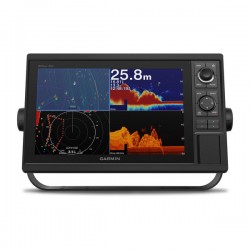
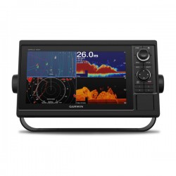
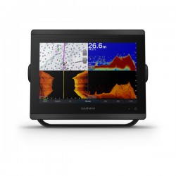
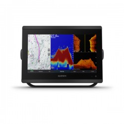
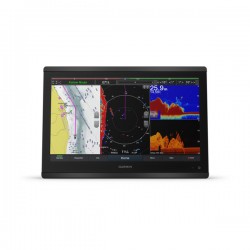
GET A SHARPER VIEW FROM YOUR CONNECTED HELM
With 60% more display pixels and nearly double the processing power of previous-generation 7-inch GPSMAP devices, this crisp high-resolution chartplotter/sonar combo integrates seamlessly into your Garmin marine system.
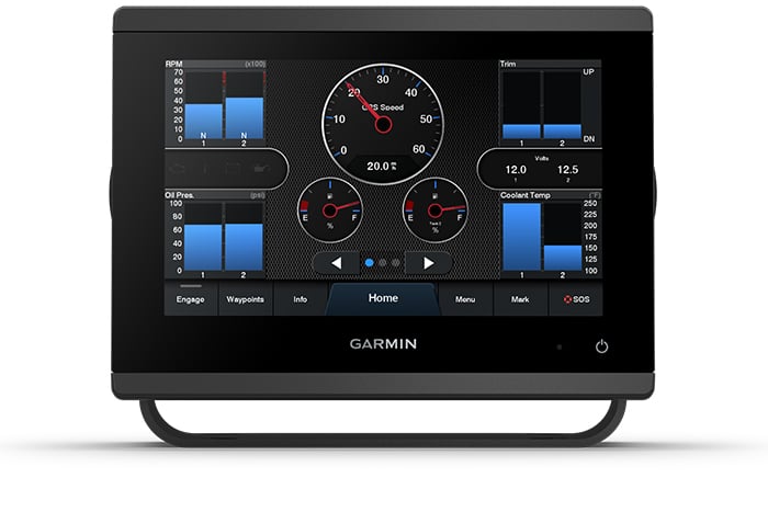
Easily integrate with more engines.
Connect to compatible third-party devices with OneHelm™digital switching.
Easily build your marine system using the best of network connectivity.
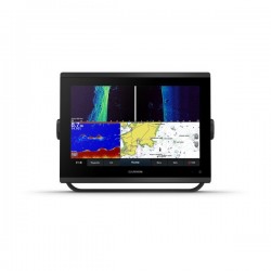
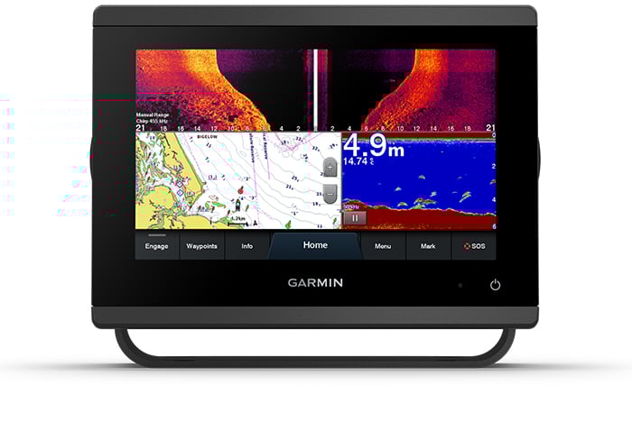
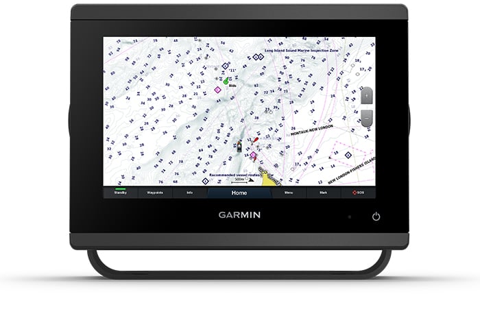
Compatible with premium maps and charts1 for the best in Garmin navigation.
See below your boat with built-in sonar capabilities.
Manage your marine experience from nearly anywhere.2
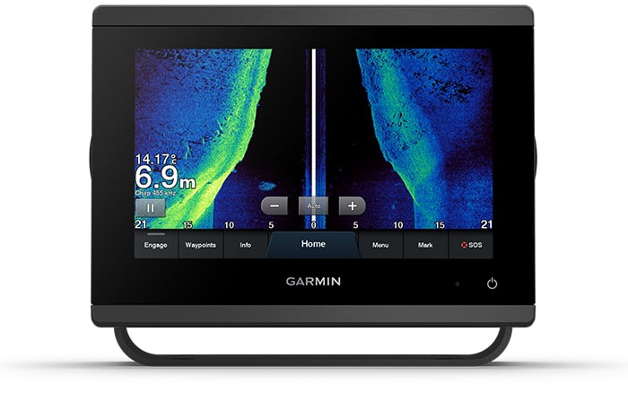
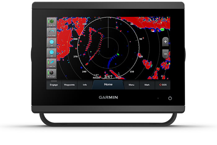
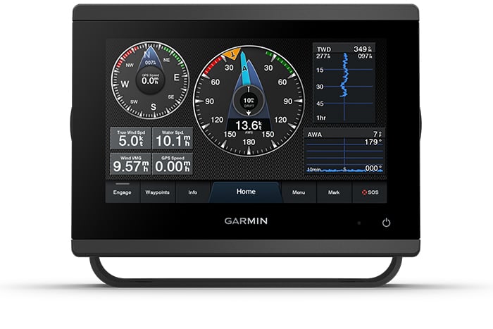
ULTRA HIGH-DEFINITION SCANNING SONAR
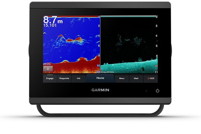
Get built-in Ultra High-Definition SideVü and ClearVü scanning sonars with vivid, high-contrast colour palettes to help distinguish fish from structure. GPSMAP® 723xsv also supports 1 kW CHIRP traditional sonar capabilities.
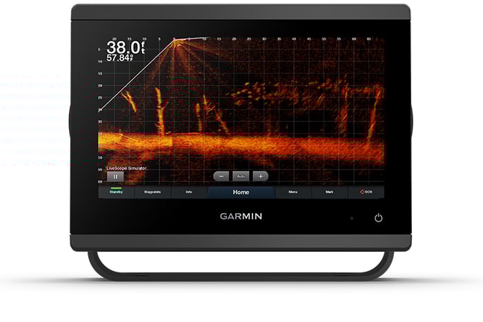
PANOPTIX™ SONAR SUPPORT
Pair with Panoptix or Panoptix LiveScope™ easy-to-interpret live sonar (transducer sold separately) to see all around your boat in real time.
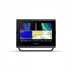
FASTER, SHARPER, SMARTER
With its added processing power and new slimline design featuring edge-to-edge glass and a smaller unit footprint, it’s easy to retrofit this 7-inch plotter in a wider range of dash configurations.
IMPROVED DISPLAY OPTICS
New higher-resolution 7-inch displays offer improved sunlight readability with 60% more pixels than previous-generation 7-inch GPSMAP devices.
OPTIONAL BLUECHART® G3 VISION® CHARTS
These optional charts offer the best of Garmin and Navionics® data, Auto Guidance3 technology and other premium navigation features.
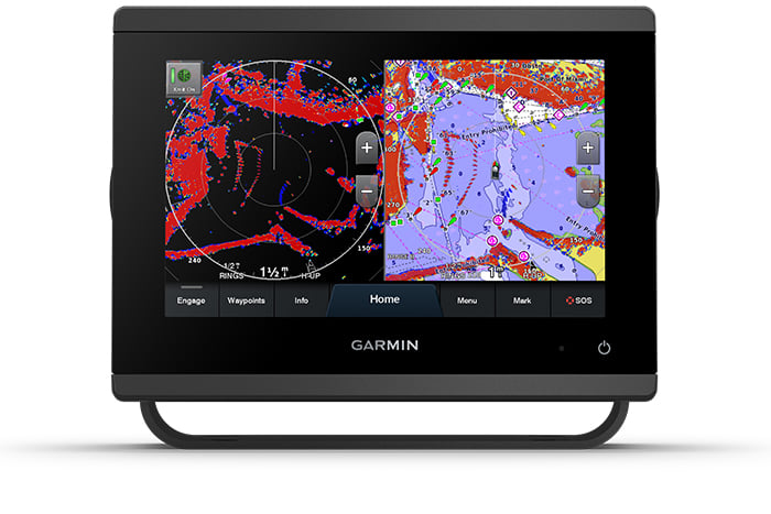
GARMIN MARINE NETWORK
If you have multiple compatible Garmin devices on your boat, you can share information — such as maps, user data, radar and IP camera video — among them.
NMEA 2000® AND NMEA 0183 NETWORKS
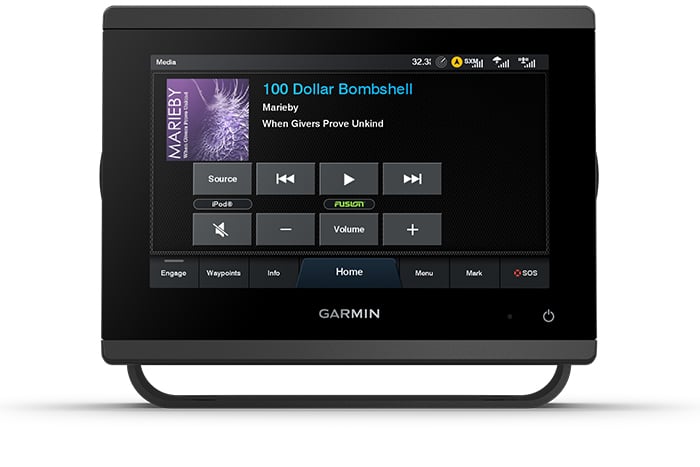
Connect to compatible autopilots, digital switching, weather, Fusion-Link™ audio system, media, VHF, AIS and more from one screen.
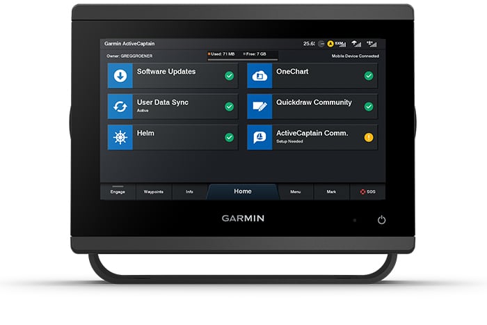
ACTIVECAPTAIN® APP
Built-in Wi-Fi® connectivity pairs with the free all-in-one mobile app for access to the OneChart™ feature, smart notifications, software updates, Garmin Helm™ digital switching, Garmin Quickdraw™ Community data and more.4
INTEGRATED ANT® TECHNOLOGY
Connect with some of your favourite devices, such as quatix®marine watches, gWind™ Wireless 2 transducers, GNX™ Wind marine instruments and wireless remote controls.
J1939 CONNECTIVITY
Now you can connect your chartplotter to different kinds of engines, including select Yamaha engines.
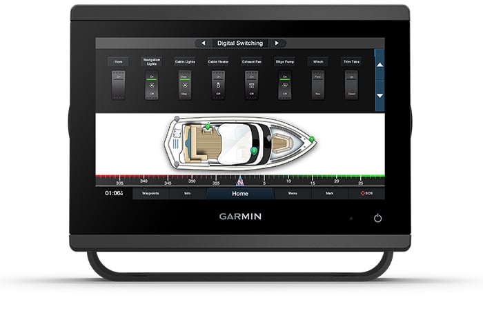
ONEHELM™ FEATURE
This exclusive feature brings together all the operations and capabilities of select third-party devices, such as EmpirBus™digital switching, on one screen.
Generale |
|
| DIMENSIONI | 9.2" x 6.4" x 3" (23.3 x 16.2 x 7.6 cm) |
|---|---|
| DIMENSIONI SCHERMO, LXA |
7.8" x 4.4"; 9.0" diagonal (19.9 x 11.2 cm; 22.9 cm diagonal) |
| RISOLUZIONE SCHERMO, LXA | 1280 x 720 pixels |
| TIPO DI SCHERMO | WXGA display |
| PESO | 3.6 lbs (1.6 kg) |
| CLASSIFICAZIONE DI IMPERMEABILITÀ | IPX7 |
| POLARIZED SUPPORT | |
| CONSUMO ENERGETICO |
Max power usage at 10 Vdc: 22 W Typical current draw at 12 Vdc: 1.3 A Max current draw at 12 Vdc: 1.8 A |
| ANTENNA GPS | Interna o esterna sulla rete NMEA 2000 |
| OPZIONI DI MONTAGGIO | Bail, flush or flat |
| RECEIVER | 10 Hz high-sensitivity |
| PORTE GARMIN MARINE NETWORK™ | 1 |
| POTENZA DI TRASMISSIONE | 1 kW traditional; 1 kW CHIRP |
Mappe e memoria |
|
| CARTOGRAFIA PRECARICATA | Worldwide basemap |
|---|---|
| MEMORIA ESTERNA | 2 microSD™ cards (back of unit) |
| WAYPOINTS | 5,000 |
| TRACK LOG | 50,000 points; 50 saved tracks |
| PERCORSI MEMORIZZABILI | 100 |
Funzioni per le attività outdoor |
|
| DATI MAREE | |
|---|---|
Funzioni del chartplotter |
|
| COMPATIBILE CON I RADAR GARMIN | |
|---|---|
| COMPATIBILE CON I BLACK-BOX GARMIN | Yes (built-in) |
| GARMIN SMARTMODE COMPATIBILE (PREDEFINITI DEL MONITOR PERSONALIZZABILI) | |
| COMPATIBILE CON FUNZIONE AIS | |
| COMPATIBILE CON FUNZIONE DSC | |
| SUPPORTA LE RADIO COMPATIBILI CON FUSION-LINK™ | |
| SUPPORTO DELL'ECOSCANDAGLIO BLACK BOX GSD™ | |
| SUPPORTO DELL'ECOSCANDAGLIO BLACK BOX GCV™ | |
| ACTIVECAPTAIN COMPATIBILE | |
| GRID™ (GARMIN REMOTE INPUT DEVICE) COMPATIBILE | |
| CONNETTIVITÀ WIRELESS | |
| FUNZIONI DI NAVIGAZIONE A VELA | |
Funzioni e specifiche dell'ecoscandaglio |
|
| DOPPIA FREQUENZA | |
|---|---|
| DOPPIO CONO | |
| FREQUENCIES SUPPORTED | Traditional: 50/77/83/200 kHz CHIRP (low, medium, high) ClearVü (260/455/800 kHz) (dependent on transducer) |
| CHIRP | Sì (integrato) |
| CLEARVÜ | Yes with CHIRP (built-in) |
| SIDEVÜ | Yes with CHIRP (built-in) |
| PROFONDITÀ MASSIMA | 5,000 ft at 1kW (depth capacity is dependent on water bottom type and other water conditions) |
| ZOOM | |
| DATI E GRAFICO DELLA TEMPERATURA DELL'ACQUA | |
| REGISTRAZIONE | |
| STORICO | |
Connessioni |
|
| NMEA 2000® COMPATIBILE | |
|---|---|
| NUMERO DEI PIN DEL TRASDUTTORE | 12-pin (orange) |
| PORTE DI INGRESSO NMEA 0183 | 1 (Differential) |
| PORTE DI USCITA NMEA 0183 | 1 (Differential) |
| PORTE DI INGRESSO VIDEO | 1 BNC |
| CONNETTIVITÀ WIRELESS | |
| J1939 COMPATIBLE | |
Confezione:
-
- GPSMAP 923xsv chartplotter
- microSD™ card preinstalled
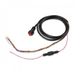
- Power cable
- NMEA 2000® T-connector
- NMEA 2000 drop cable (2 metres)
- 8-pin transducer to 12-pin sounder adapter cable
- Bail mount kit with knobs
- Flush mount kit with gasket
- Protective cover
- Trim piece snap covers
- Documentazione