Nessun prodotto
Prodotto aggiunto al tuo carrello
Ci sono 0 articoli nel tuo carrello. Il tuo carrello contiene un oggetto.


Dettagli
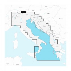
BLUECHART® G3 VISION®
La cartografia ad alta precisione BlueChart g3 Vision permette di ottimizzare ulteriormente la vostra navigazione grazie a caratteristiche avanzate come immagini satellitari ad alta risoluzione, viste prospettiche e visualizzazione in 3D sopra e sotto il livello del mare, tecnologia Auto Guidance, foto aeree di porti, baie e marine, nonché di idrovie e strade costiere con punti di interesse. Auto Guidance 3.0 offre indicazioni per raggiungere la destinazione desiderata e suggerimenti per la navigazione (ad esempio, per l’entrata e l’uscita dai porti); inoltre cerca sempre la rotta più breve.
Premier Coastal Charts
- Industry-leading coverage, clarity and detail with updated coastal charts that feature integrated Garmin and Navionics® content
- Auto Guidance¹ technology quickly calculates a suggested route by using your desired depth and overhead clearance
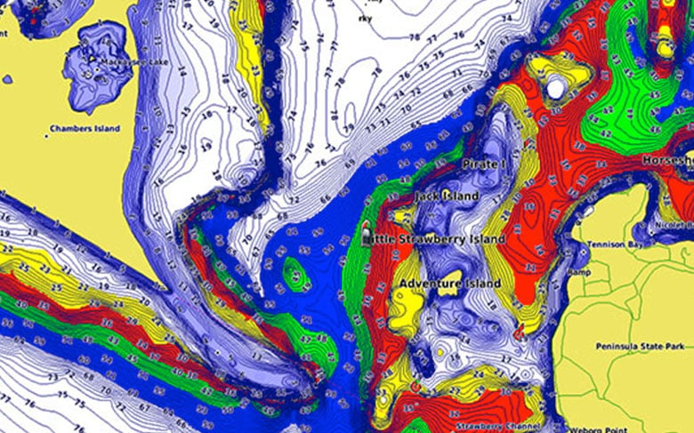
- Includes Depth Range Shading for up to 10 depth ranges, enabling you to view your target depth at a glance
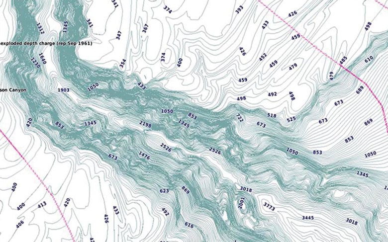
- Up to 1’ contours provide a more accurate depiction of the bottom structure for improved fishing charts
- To give a clear picture of shallow waters to avoid, the Shallow Water Shading allows for shading at a user-defined depth
Experience unparalleled coverage and brilliant detail when you’re on the water. BlueChart g3 Vision coastal charts provide industry-leading coverage, clarity and detail with integrated Garmin and Navionics content.
Auto Guidance
Whether you are fishing or cruising, select a spot, and get a route showing you the general path and nearby obstructions at a safe depth1.
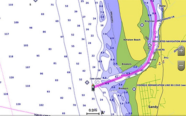
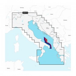
Depth Range Shading
This feature displays high-resolution Depth Range Shading for up to 10 depth ranges so you can view your designated target depth.
Shallow Water Shading
To give a clear picture of shallow waters to avoid, this feature allows for shading at a user-defined depth.
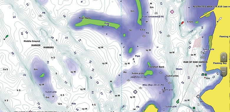
Detailed Contours
BlueChart g3 Vision charts feature 1’ contours that provide a more accurate depiction of bottom structure for improved fishing charts and enhanced detail in swamps, canals and port plans.
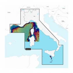
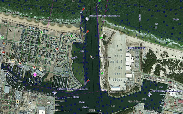
High-resolution Satellite Imagery
High-resolution satellite imagery with navigational charts overlaid gives you a realistic view of your surroundings. It’s our most realistic charting display in a chartplotter — ideal for entering unfamiliar harbors or ports.
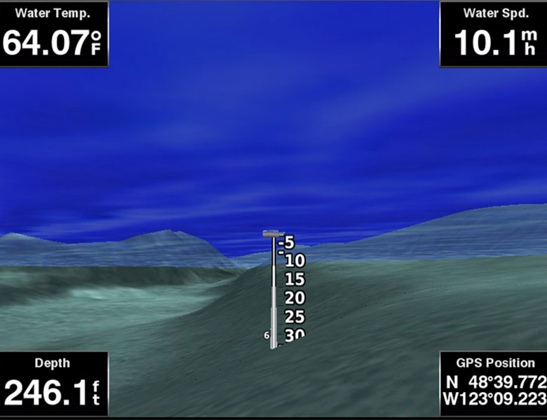
FishEye View
This underwater perspective shows 3-D representation of bottom and contours as seen from below the waterline. Interface with sonar data for a customized view.
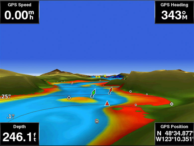
MarinerEye View
This view provides a 3-D representation of the surrounding area both above and below the waterline.
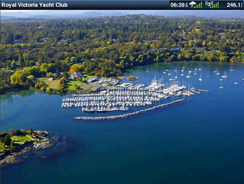
Aerial Photography
Crystal-clear aerial photography shows exceptional detail of many ports, harbors and marinas and is ideal when entering unfamiliar ports.